Aethera
An original fictional world for AeroSim’s continent-selection prototype. Choose one of three named continents for a future flight-setup handoff; no simulator connection, flight rendering or terrain loading is implemented.
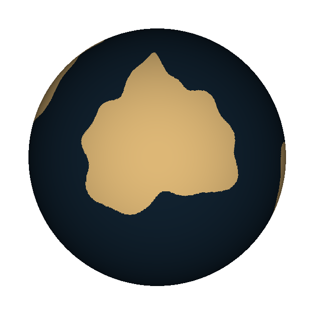
Static atlas · Interactive view requires WebGL
A new world. Choose a continent.
Three continents, three terrain studies. Choose a landmass, then open its documentation.
- Surface
- Original procedural coastlines
- Purpose
- Continent selection only
Three continents, three terrain studies
| Continent | Associated terrain study |
|---|---|
| Verdant Reach → | Training Airfield |
| Crownspire → | Mountain Valley |
| Tideward → | Coastal Range |
These are the same three terrain models and review pages, grouped under Aethera. Their binaries, source provenance and review status have not changed. Each is associated with exactly one named continent. The globe shows their catalogue association, not the physical extent or surveyed placement of the local terrain meshes. No stitched planetary terrain, scale, climate or flight environment is implied.
Measured preview sizes
Open a model for its measured horizontal size, vertical span and geometry counts. These are local preview extents in authored metres, not the sizes of Aethera’s continents. Training Airfield shows only the 6 × 6 km core of its declared 100 × 100 km package.
A planet of its own
Aethera uses original, deterministic procedural coastlines, not Earth's map with a new name. Exactly three separate landmasses represent Verdant Reach, Crownspire and Tideward, matching the selector and child pages. Their names describe the associated terrain studies; outlines and label points are fictional presentation choices, not approved flight environments or terrain requirements. The static fallback and interactive globe use the same fictional map.
Drag horizontally or use arrow keys with the globe focused. Pause rotation holds the view; Reset view restores its starting orientation. Reduced motion disables automatic rotation. If WebGL is unavailable, the static concept globe and every terrain link remain usable.
How it is made
The shared component uses COBE (source and MIT license). COBE 2.0.1 has no public custom-map option. A small, version-pinned local package patch adds a map-texture input and loading callbacks; the globe renderer and shaders remain COBE's. This extension is maintained locally, not an upstream COBE API. Original masks and reproducible generation are documented in src/components/planet-globe/README.md.
The user-selected direction is to reuse COBE for continent selection in the flight simulator later. That is future integration intent, not implemented application behavior or selection of a flight-terrain engine. Earth remains the separate, real-world geography reference.